1uffakind    
home    you    me     work    
  print     interactive    packaging+merch    robotics    identity    code    art    
 
   online maps    custom web apps    ecommerce    brochureware+portfolios    large organizations    games &c    
 
    1uffakind    
    

online map websites

    
«


Public Lands Information Center


Online Atlas of Historic New Mexico Maps


Galisteo Basin Archaeological Sites


El Camino Real National Historic Trail


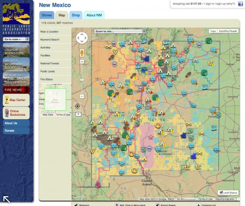
Public Lands Information Center

1 Jul 2014

1uffakind helped the Public Lands Interpretive Association convert its old, hand-drawn, image-mapped gifs (created circa 1998) into a very slick and functional Google API-based map. Use the map to explore nearly 10,000 outdoor recreation destinations across eleven western states, as well as millions of acres of state and managed public lands.

Public Lands Information Center »
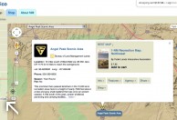
 

»
  

work » interactive » online maps

website and contents copyright ©1997 - 2024 c . goldsmith \ all rights reserved